PROJECT: Azulik Residences
YEAR: 2024
LOCATION: Tulum, Mexico
NATURE: Professional
FIRM: Roth Architecture
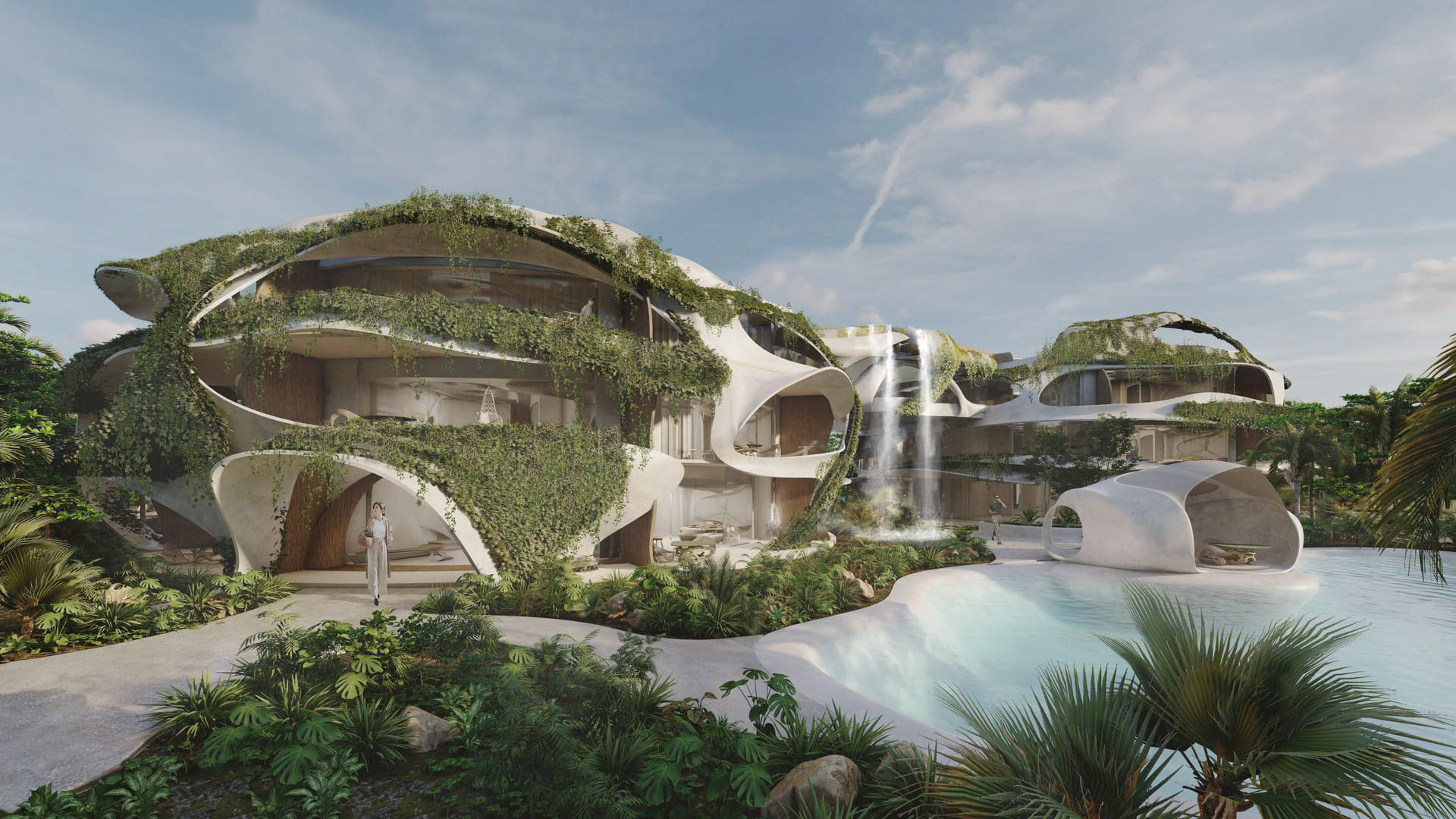
Azulik Residences is an innovative project that harmoniously blends sustainable luxury with the surrounding natural environment. Conceived as habitable sculptures, the residences feature organic forms while carefully preserving the site’s original topography. This thoughtful approach fosters a profound connection between living spaces and nature, promoting conservation and a sustainable lifestyle. The project comprises four towers linked by bridges, housing a total of 88 apartments. I contributed to this project by optimizing the master plan using custom Grasshopper definitions, ensuring minimal impact on the original terrain. Furthermore, my contribution includes helping developing façades, prefabricated staircases, and amenities, as well as producing detailed construction documentation such as technical drawings and sections. Throughout the process, I collaborated closely with multiple divisions—construction, interior design, FabLab research, and 3D artists—gaining valuable experience in coordination and communication within an international architectural firm.
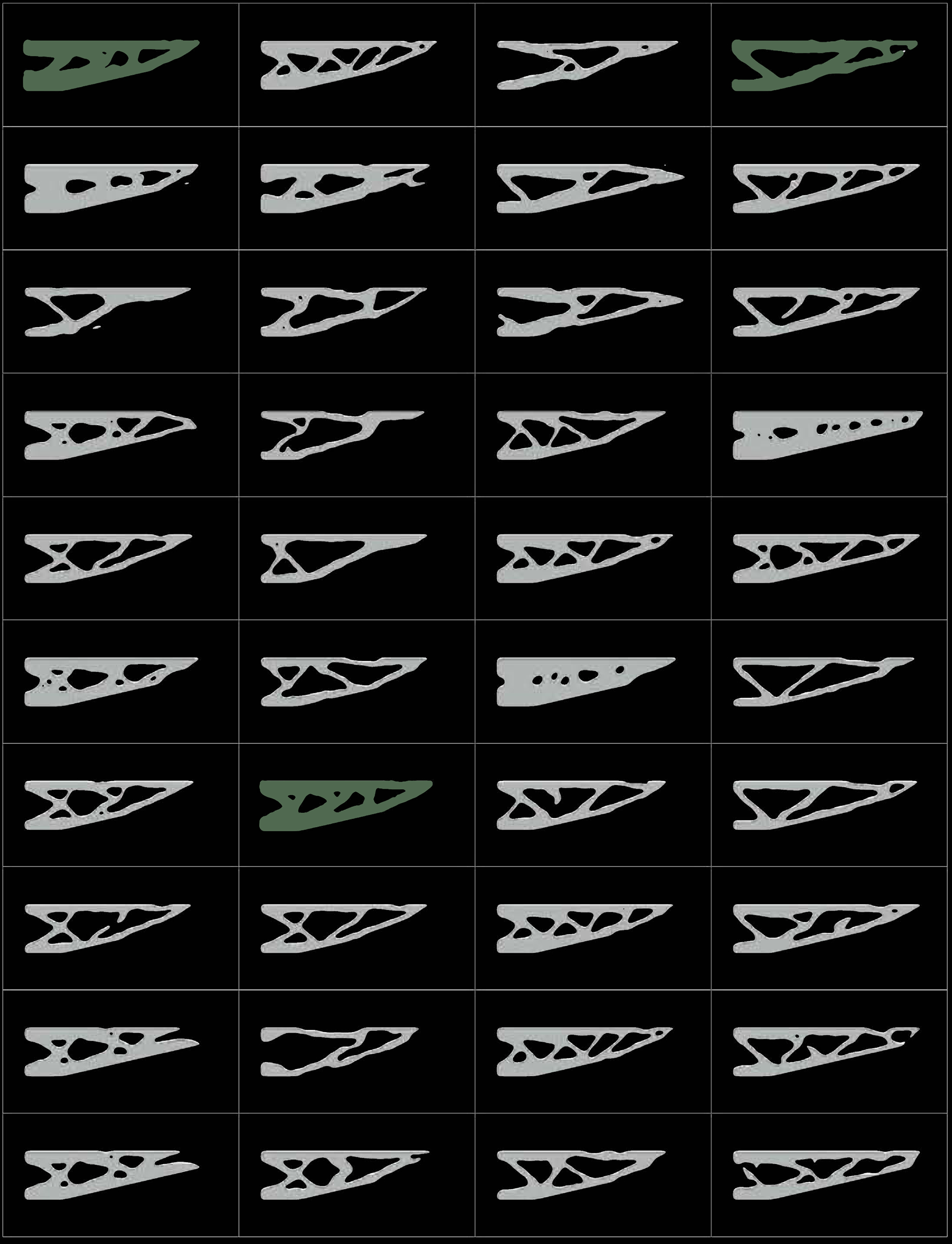
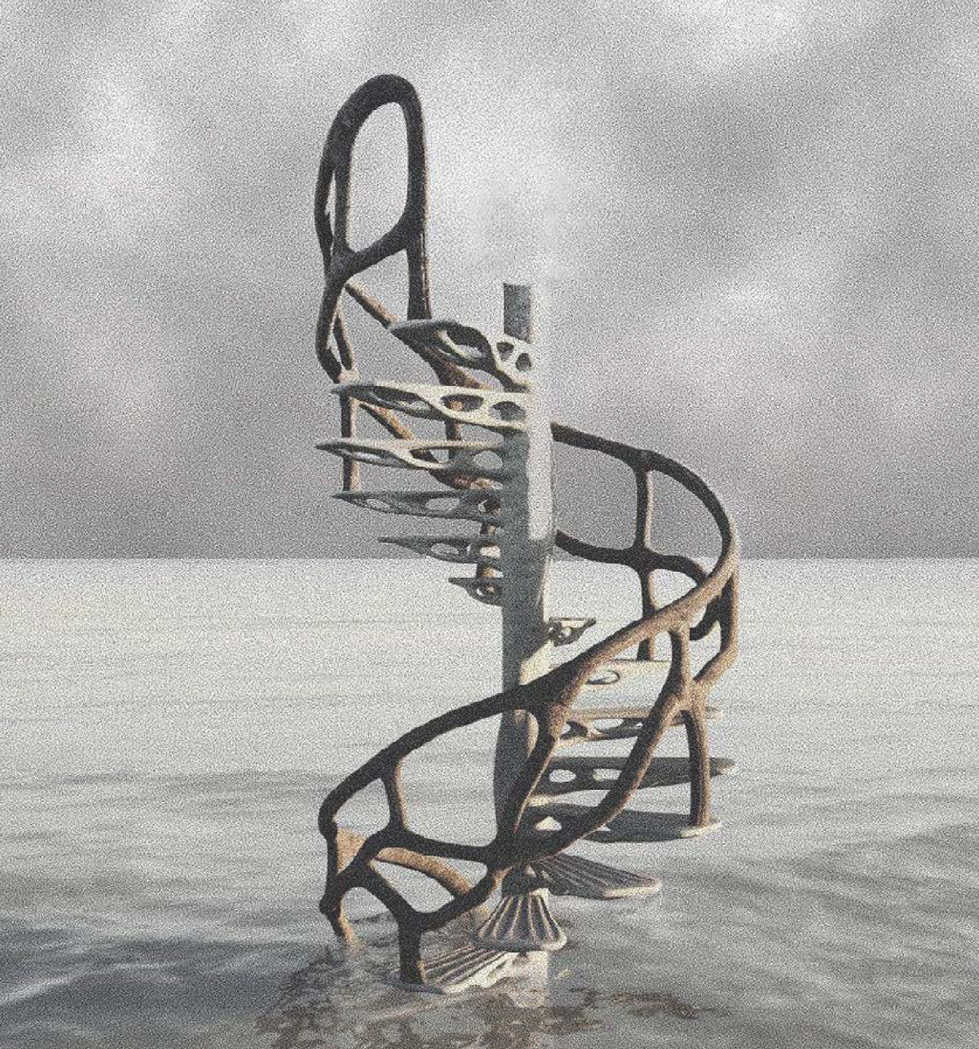
STAIRS: TOPOLOGICAL OPTIMIZATION
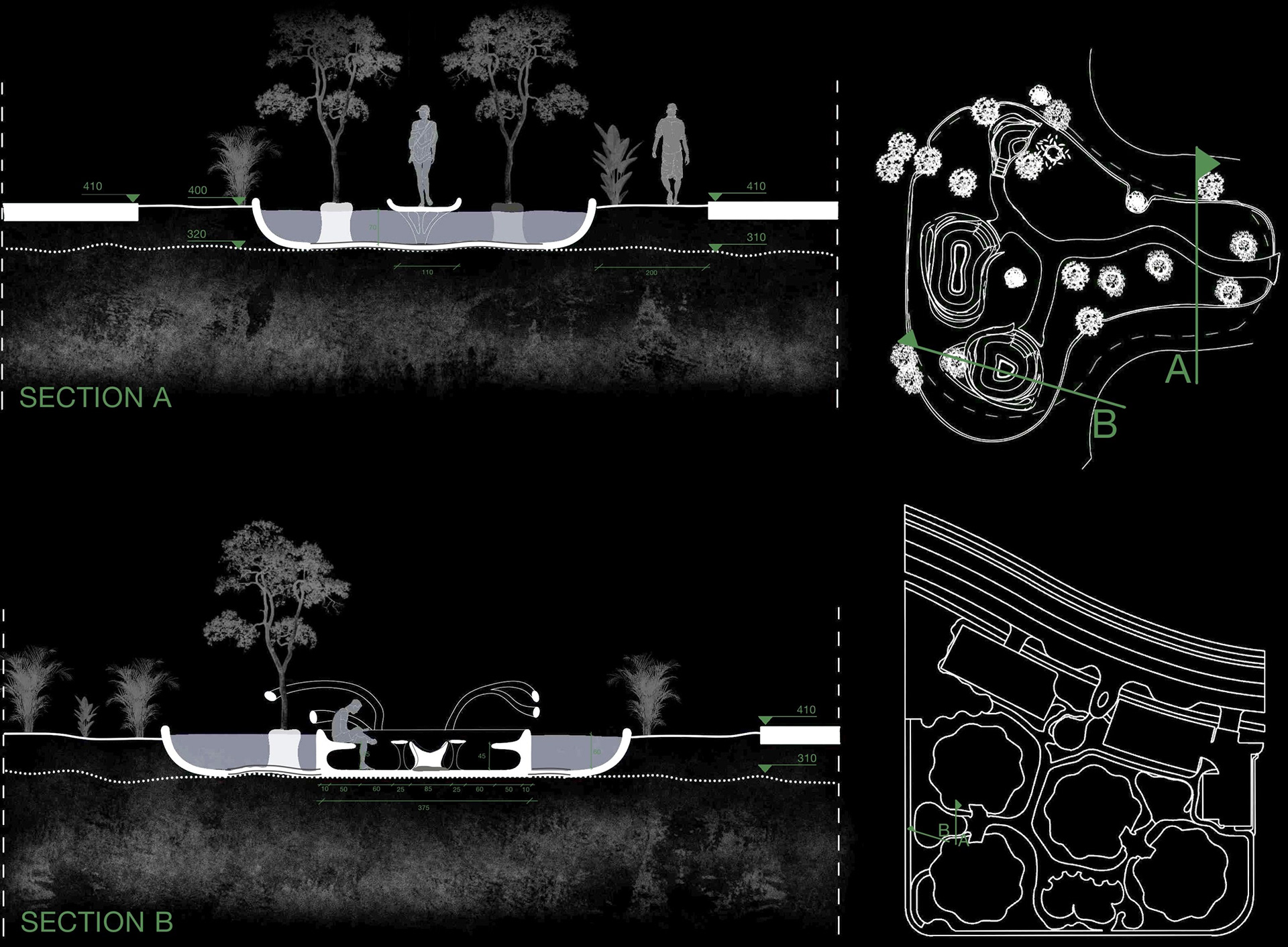
This project involved the design of organically shaped, prefabricated stairs for apartment units with roof access. Inspired by topological optimization studies (Grasshopper), the steps not only exhibit an organic form but also offer structural efficiency. After selecting the optimal results they were converted into 3D models using SubD in Rhino after which prototypes were 3D printed for assessment. The final staircase will be produced using GFRC and molds at the FabLab in the coming months. Artistic renders were created to visualize the design in context.
FIREPIT DESIGN & DOCUMENTATION
The firepit is one of the key amenities within the Azulik Residences project, where I had the creative freedom to design the space under the condition of incorporating three distinct seating areas. I chose to integrate a water mirror feature, sinking organically shaped seating areas into the water, and preserving existing trees as part of the design. This approach creates relaxation zones that immerse users in nature, embodying the spirit of Roth Architecture. In addition to the design, I was responsible for the complete documentation, renders, and a video presentation of the space.
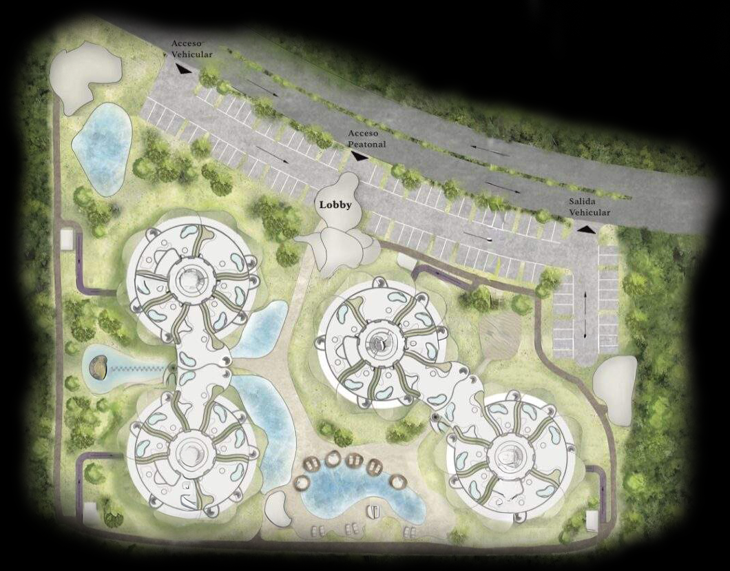
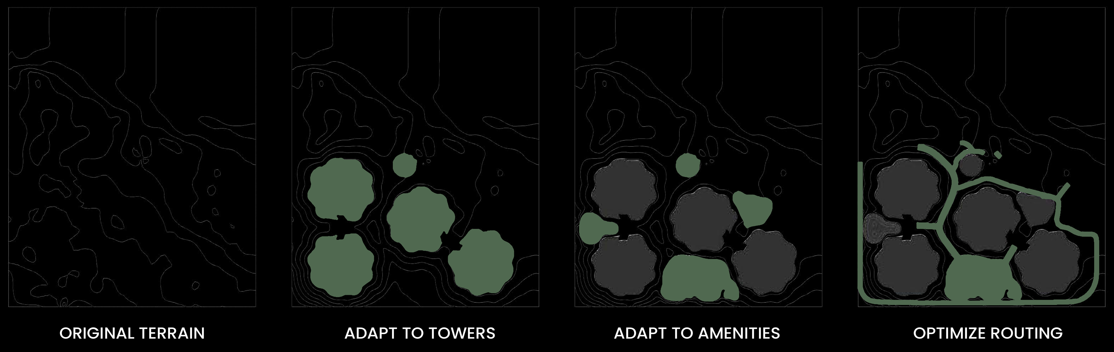
MASTERPLAN OPTIMIZATION
For the masterplan studies, my task was to optimize the design based on three key priorities:
1. Preserving the original terrain as much as possible, minimizing excavations for the basement.
2. Ensuring ground-floor terraces are directly connected to the terrain, creating the effect of an extended garden.
3. Designing the terrain with comfortably walkable slopes, making the entire site fully accessible.
2. Ensuring ground-floor terraces are directly connected to the terrain, creating the effect of an extended garden.
3. Designing the terrain with comfortably walkable slopes, making the entire site fully accessible.
To achieve these goals, I developed a Grasshopper script that manipulates the terrain to meet these requirements. The script ensures that the amount of excavated soil always exceeds the amount of refilled soil and us structured as illustrated in the diagrams shown above.
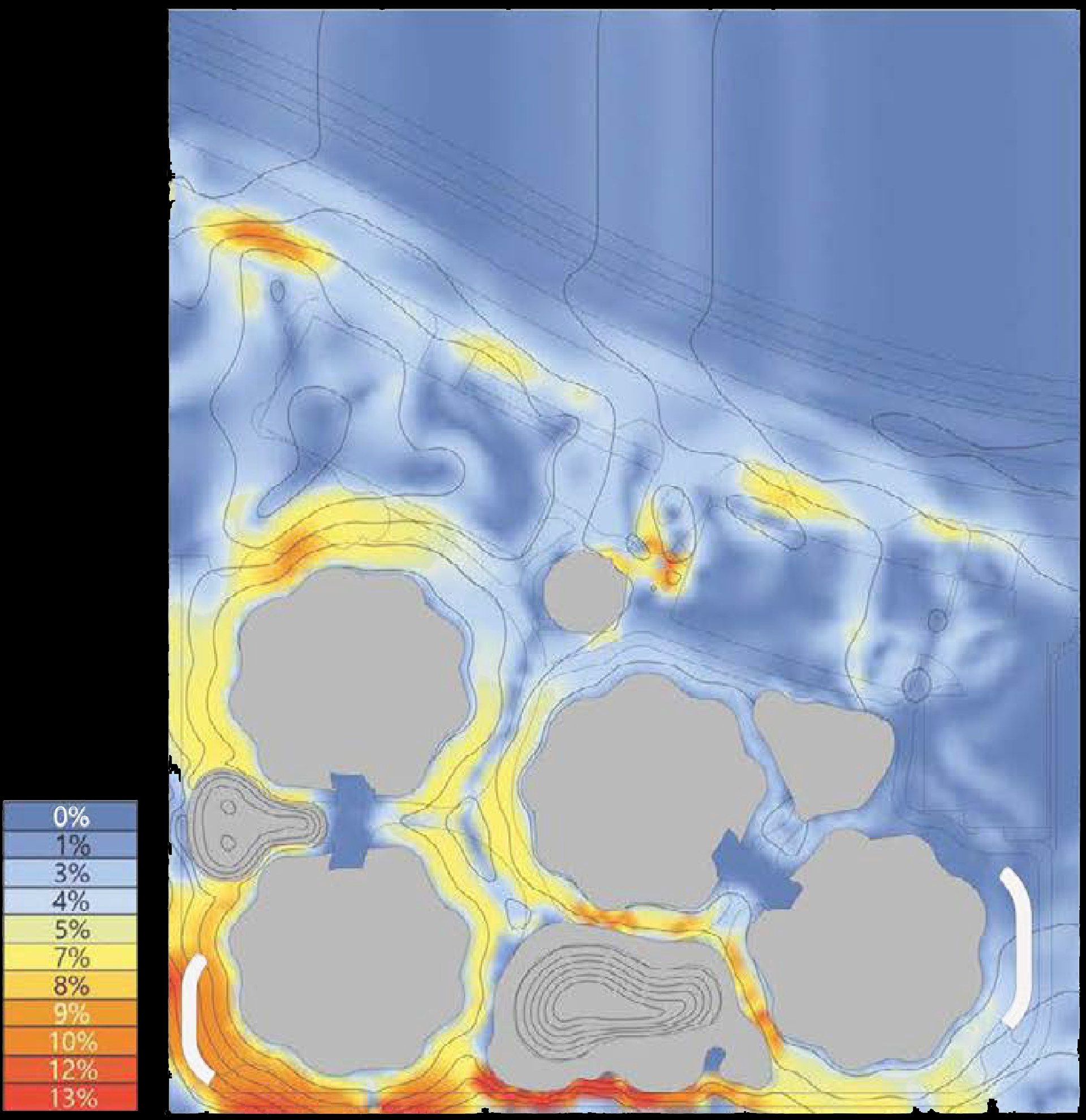
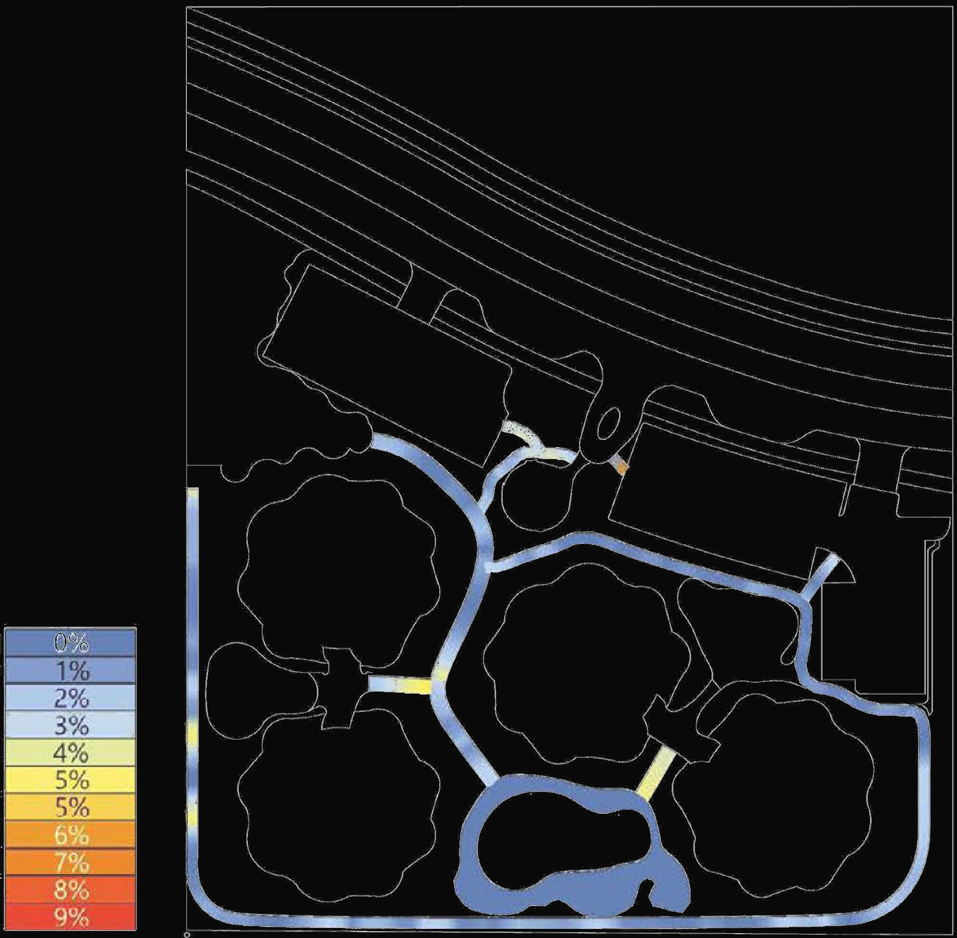
1. SLOPE PERCENTAGES
First of all, the terrain is manipulated in order to be connected to the ground floor slabs, creating extended gardens. After, amenities are carefully placed, taking advantage of the resulting topography. As shown in the slope percentage heatmap, problems arise with the significant slope percentage in the SW corner, where paths are planned to be placed.
2. RETAINING WALL SOLUTION
In order to solve the issue addressed in the previous diagram, a retaining wall is proposed on the southern border of the plot. As a result, all problematic slopes have disappeared and less soil has to be moved around.
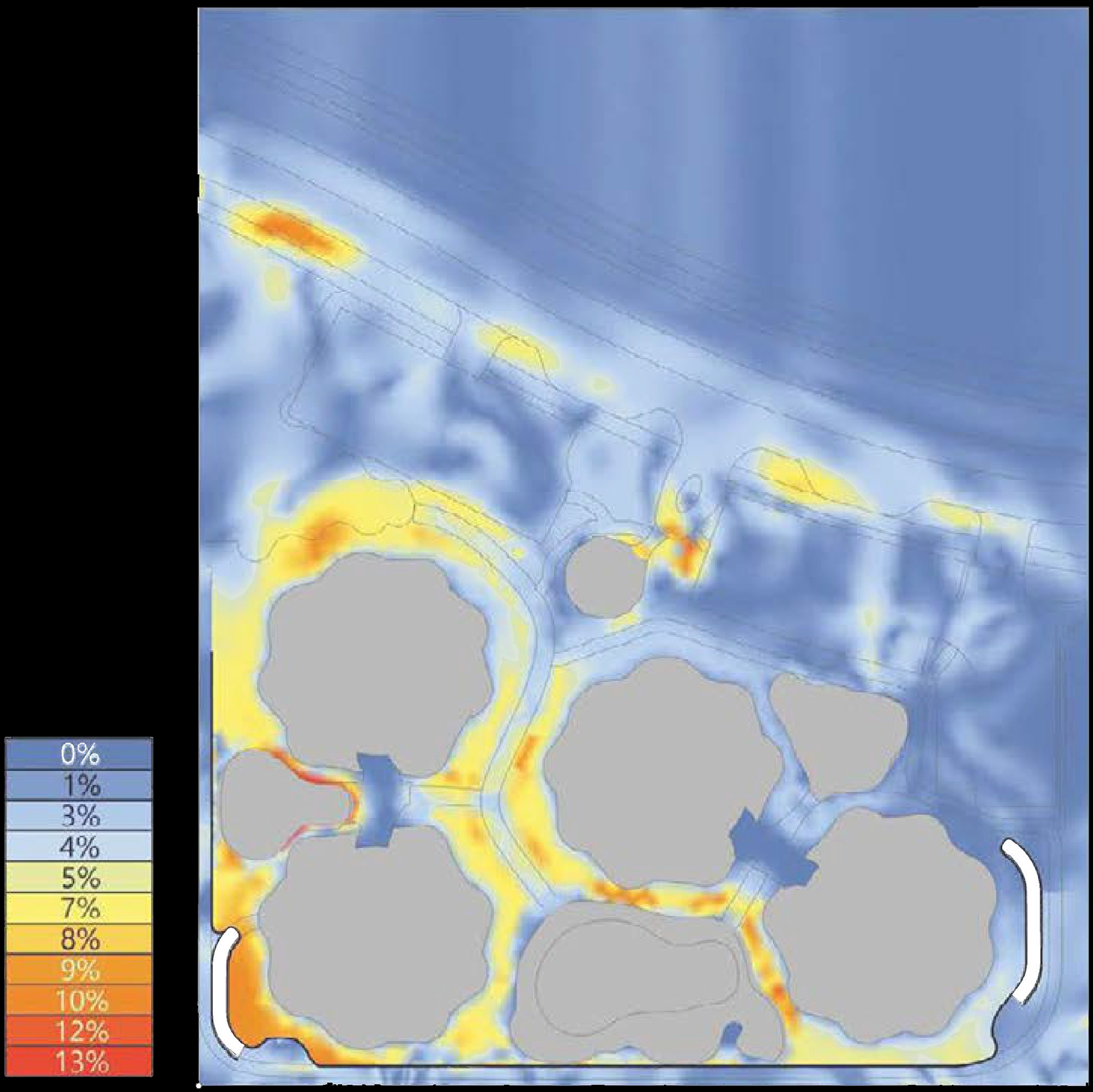
3. OPTIMIZE PATHS
Once the height and placement of the towers and amenities have been determined, pathways are optimized to fit through the resulting topography with minimal slope percentages. As seen in the heatmap, all slopes are comfortably walkable.
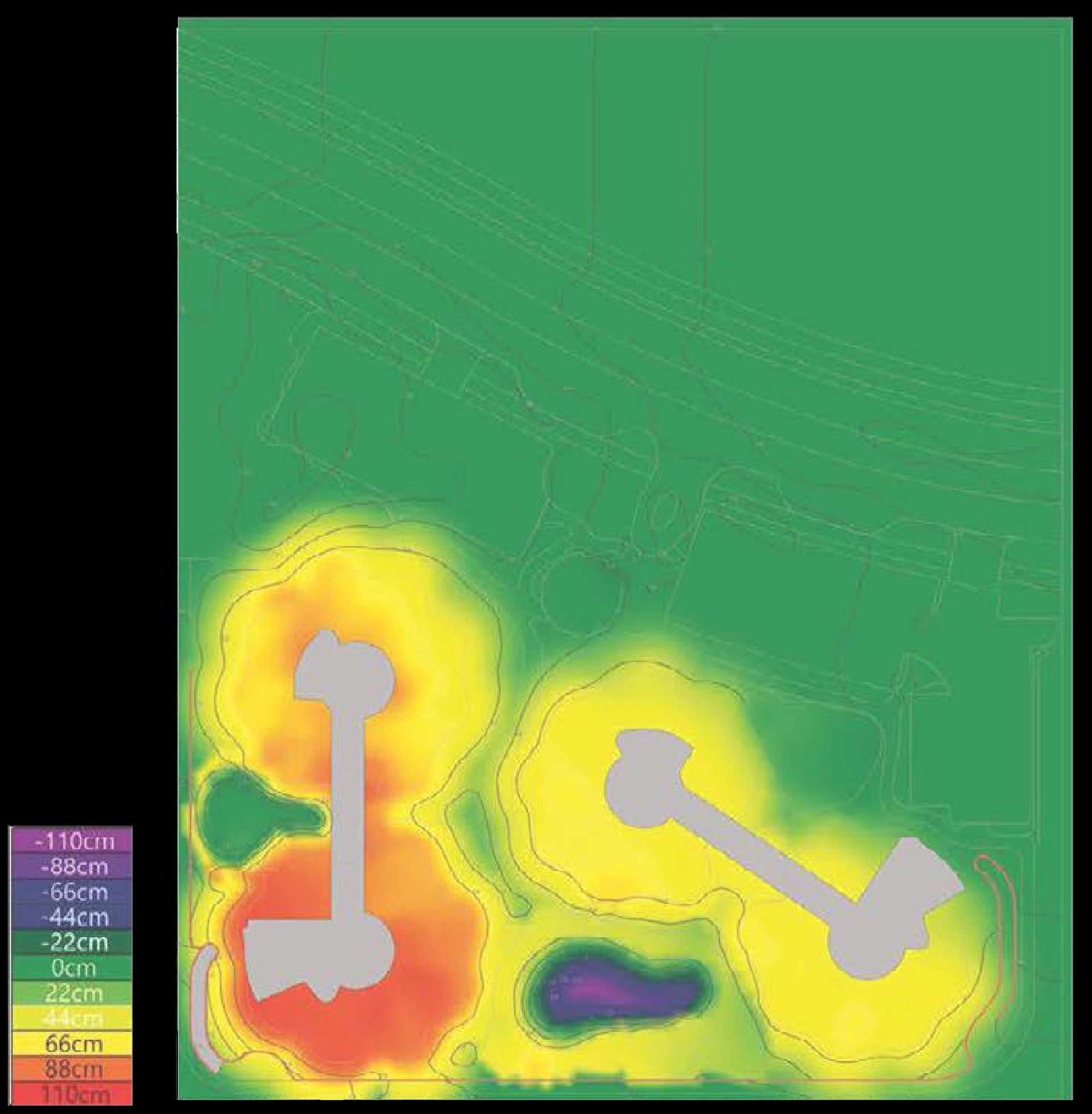
4. FINAL TERRAIN DISPLACEMENT
The resulting terrain is documented with contour lines, sections and cut & fill maps. The amount of soil excavated in order to build the basements is - as calculated- sufficient to refill the terrain where needed in order to achieve the desired landscape.
FINAL MASTERPLAN